Pattern 003 Landscape Signatures
Based on a lecture at the Accademia di architettura, Università della Svizzera italiana, in Mendrisio, Ticino, Switzerland, on 23 October 2026.
In September 2011, a few friends and I quit our crappy jobs, piled into a car, and drove from Chicago to lower Manhattan to join a planned protest. I had no university education and was working in a cafe. After liquidating my life and saying goodbye to my mom, I found myself taking part in what became known as Occupy Wall Street. Within a day, we had set up camp in a nearby privately owned park. Our numbers grew from dozens to hundreds to thousands.
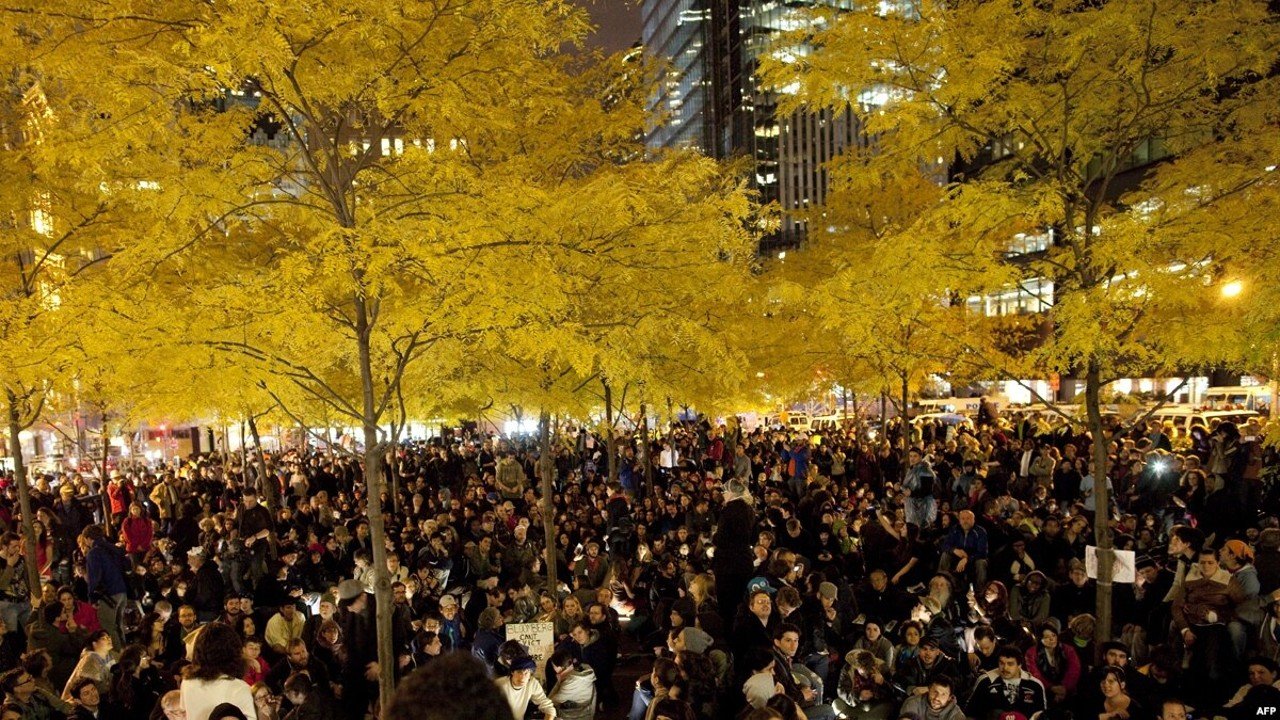
We lived there for the next two months. We built outdoor kitchens, tent communities, and libraries, and adopted a governance structure inherited from anarchist and protest movements elsewhere in the world. Meanwhile, occupations spread across the United States and internationally. There was a catchy and usefully nonspecific slogan, “We Are the 99%.” There was social media, which had not yet become a total brainrot and which people actually used to engage with others they might otherwise never have spoken to. But more important than either was the audacity to take up, appropriate, and change the space of the financial district.
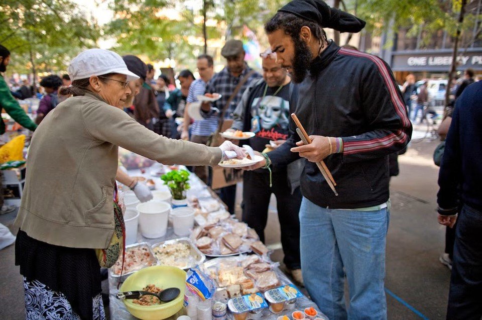
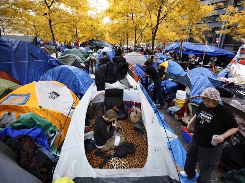
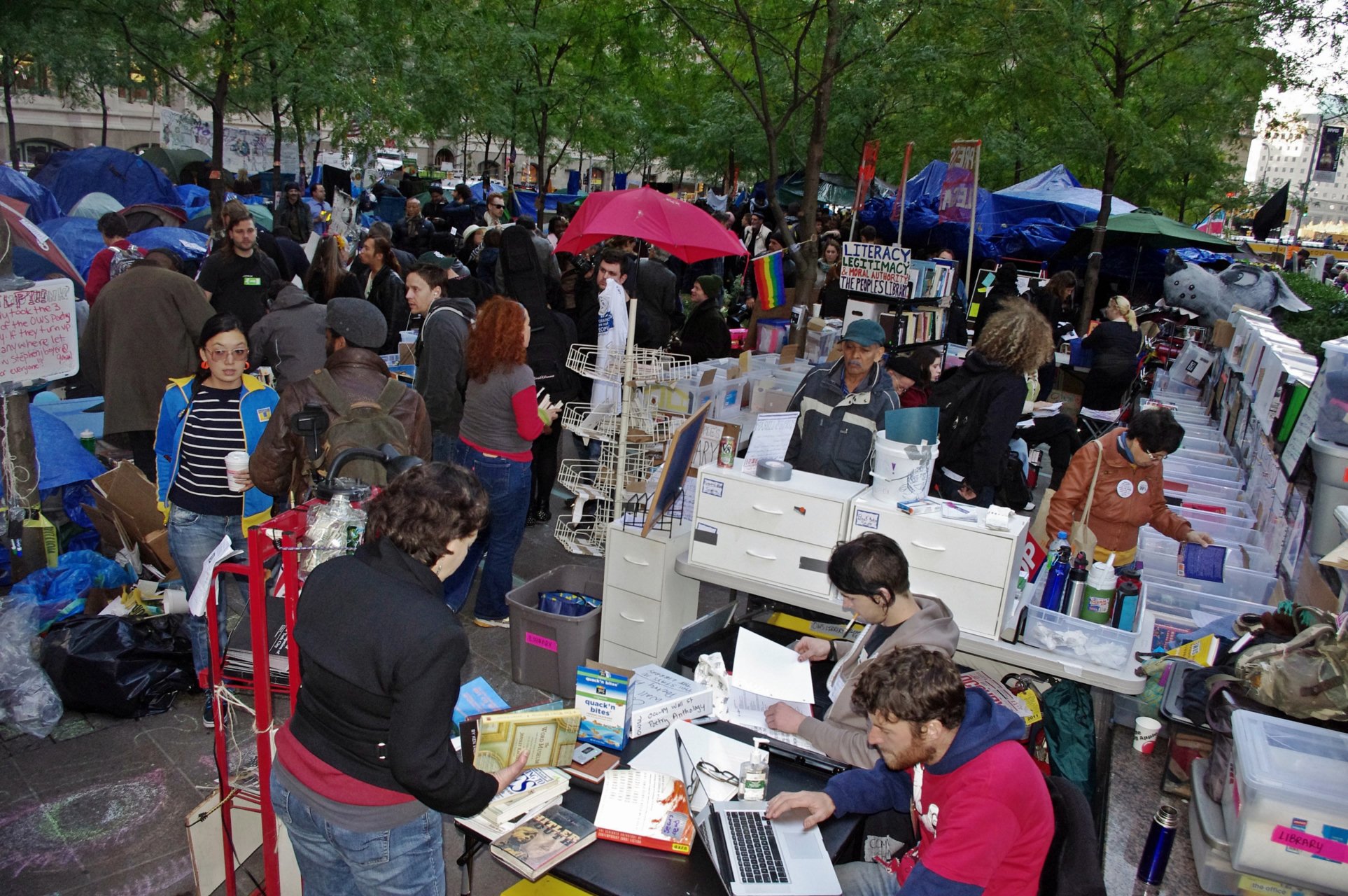

By early November, competing factions, infighting, and pressure from the New York Police Department were pulling the whole thing apart. A coherent political program never emerged, yet the movement had spread globally across physical and digital space. Occupy's power was spatial. People could recognize a relationship between their own conditions and those of others, and take up the practice of occupation, without agreeing on a single message.
The movement exposed an incompatibility between scales of a shared structure that was at once linguistic, spatial, and cultural. The relationships through which people recognized a common condition globally were in conflict with the relationships through which that condition was organized and reproduced in everyday life. The structure of feeling running through Occupy was part of this contradiction: people were coming to recognize themselves together through a world whose organization at other scales frustrated what that recognition made possible.
Occupation worked on this contradiction by changing the relations themselves. Cooking, sleeping, arguing, and making decisions together changed what people could do and what they could see others doing. As these arrangements circulated through images and digital networks, a local reorganization became something people elsewhere could recognize and enact in their own conditions. Perception and action changed together across scales. This reciprocal reorganization gave the movement a coherence in practice that it never achieved as a common political statement.
I left and took part in other reclamations of public space: guerrilla gardens and farms in California, then, in the summer of 2012, a project called The Cooperation Operation in the Chicago neighborhood where I had grown up. Over the next few years, my neighbors and I turned a piece of polluted land into a public park and urban farm.
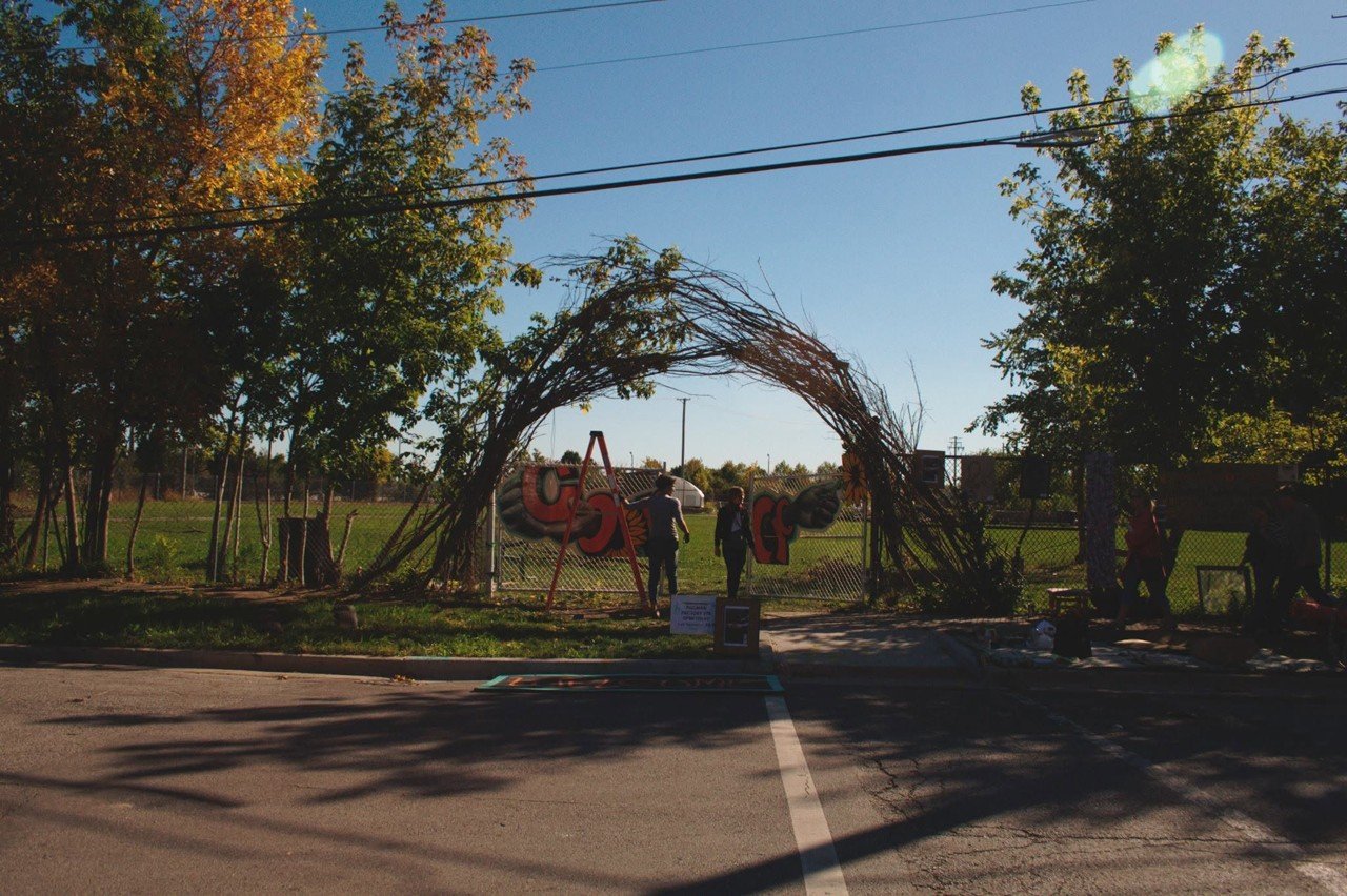
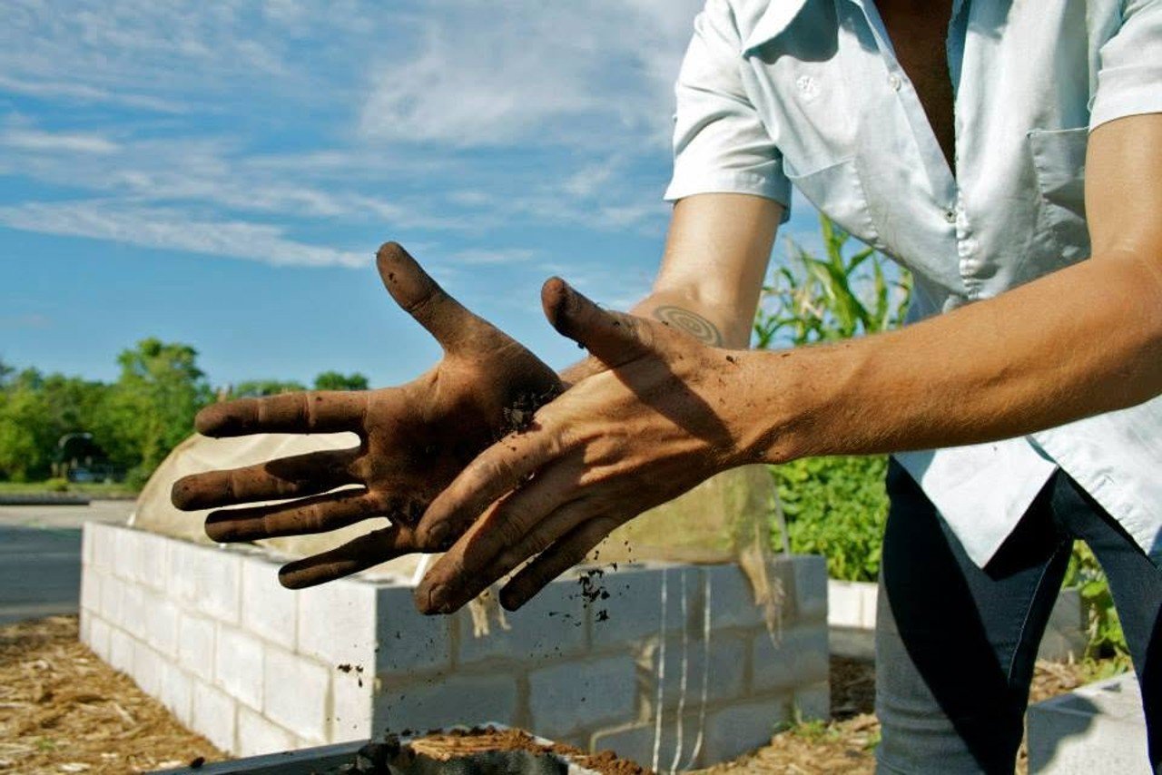
This is how I got mixed up with design. I did not have a fully developed theory of it at the time. Changing the places we lived seemed like the most expedient way of changing the things I did not like about society. The question that followed me into landscape architecture, computational design, and eventually research was why this should work at all. Why would space be political in the first place?
A path is an instruction and a record
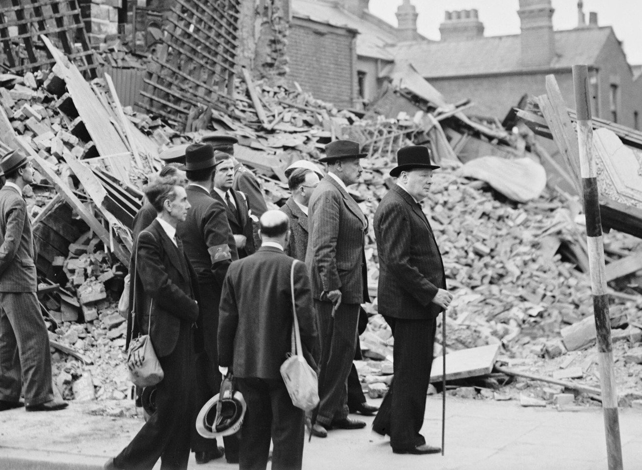
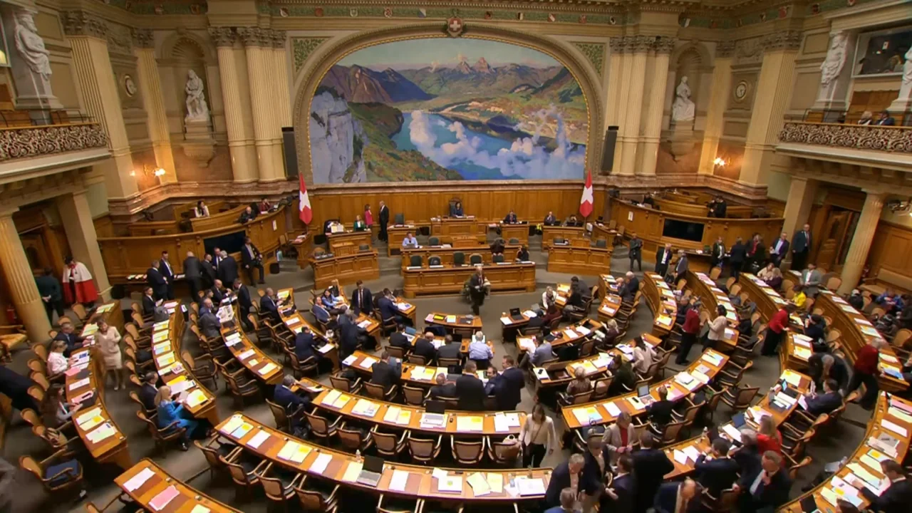
The implication is that we do more than perceive space. Space acts upon us: it changes our ideas and reconfigures what we understand to be possible. During the debate over rebuilding the House of Commons after its destruction in the Blitz, Winston Churchill put it succinctly: “We shape our buildings and afterwards our buildings shape us.” I suspect this is more literally true than even Churchill realized.

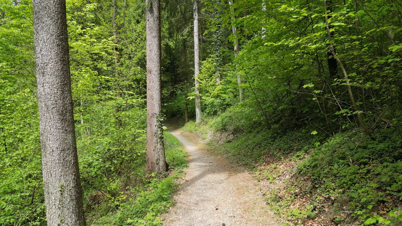
Consider a perfectly mundane forest path. Its width, texture, and condition offer cues about whether it is frequently used, whether anyone maintains it, and whether we can trust it to lead somewhere. It is an instruction written into the forest about how to interact with it. Your body reads these cues and adjusts how you move before you stop to think about them.
The path is also a record. Footprints, animal tracks, a felled tree, and accumulated wear leave traces of use and care. And, in the psychologist James Gibson's terms, it offers an affordance: a possibility for action that exists in the relationship between a body and its surroundings. A path can make traversing a forest possible for someone who could not otherwise enter it.
The relationship works in both directions. People make a path by repeatedly walking a route, and the path draws more people along it. A pattern of movement becomes a physical structure that helps reproduce that pattern of movement.
Extend this observation to cities, regions, and countries, and geographically distinct ways of growing, building, and making begin to look like more than cultural particularities. They are instructions to users and records of use in much the same manner as the forest path.
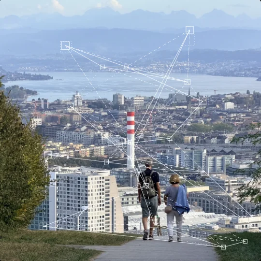
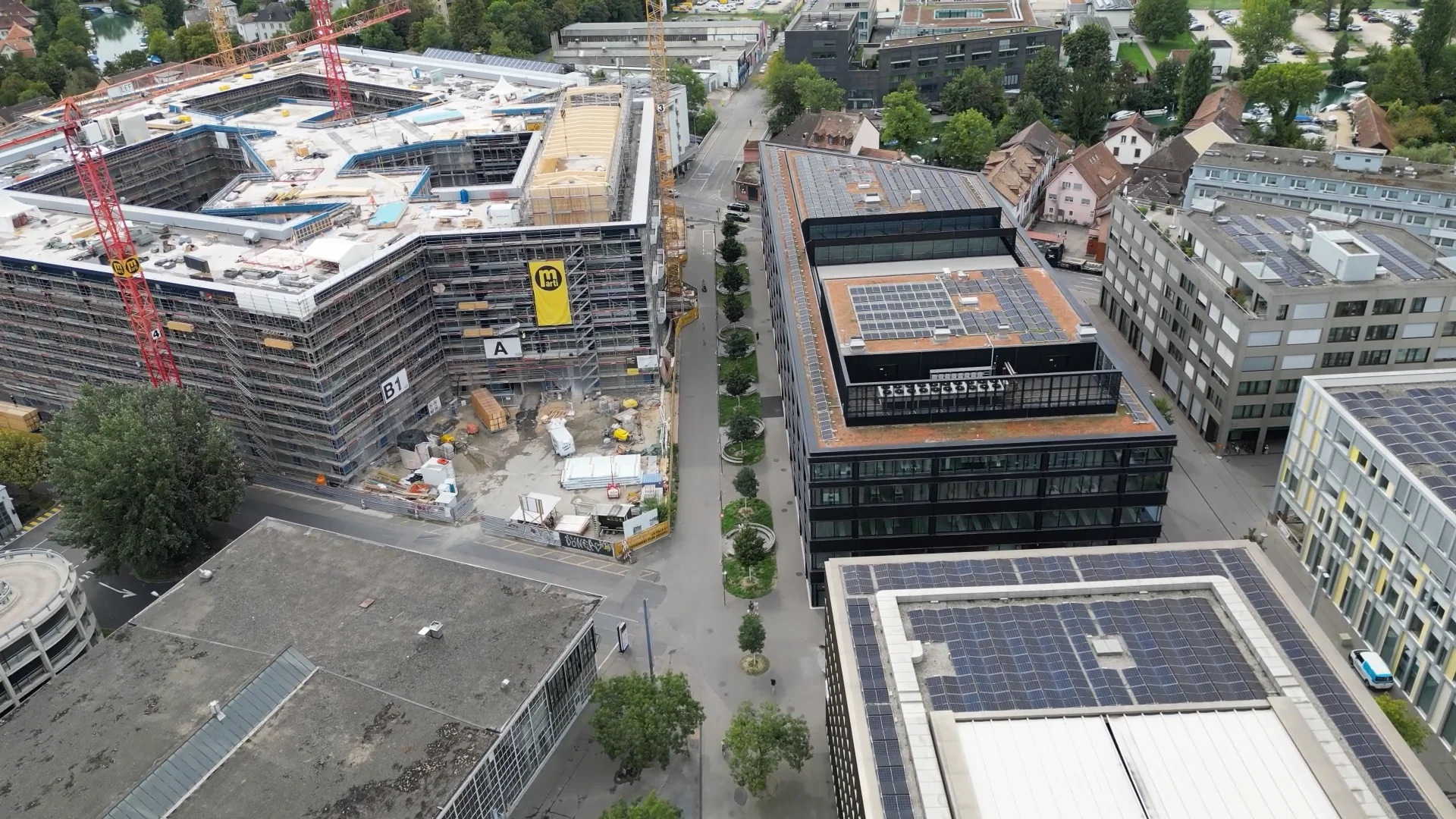
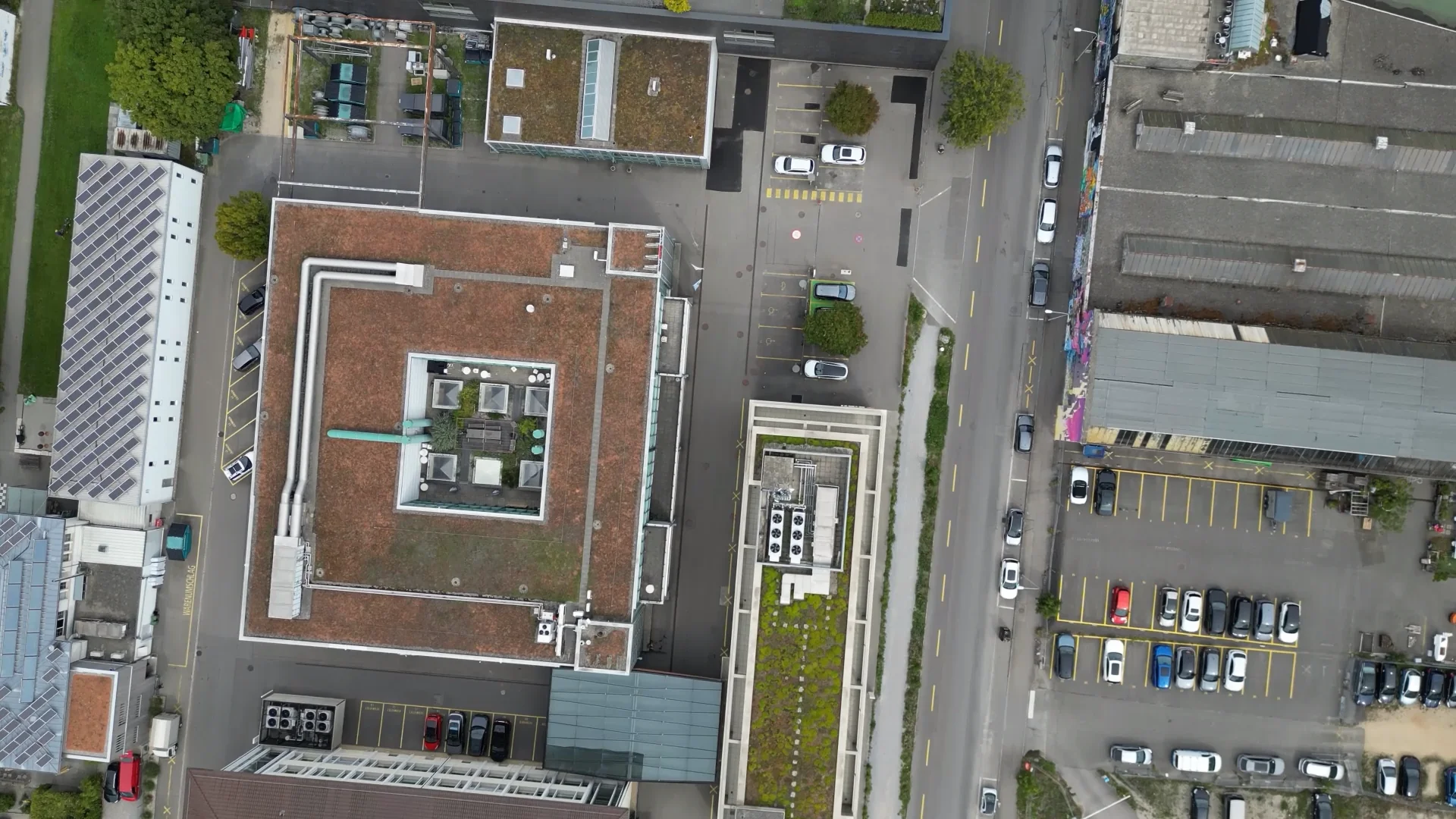
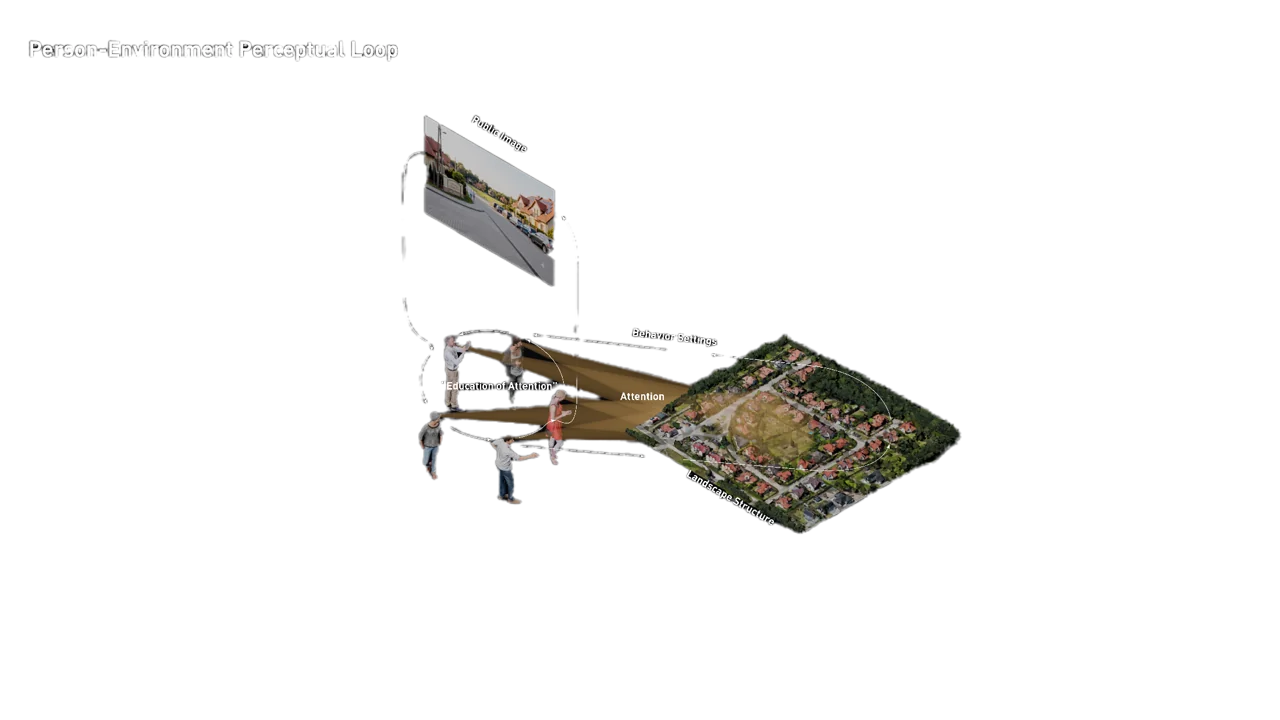
Roger Barker's concept of a behavior setting gives this coupling a name: a physical setting and a standing pattern of activity that belong together, from the everyday conduct of a street to the procedures of an institution.
A language that nobody owns
Language offers a useful way to think through this. It is the basis of much of our shared experience and even our most interior thoughts, yet it does not belong to any one of us. You do not hold the entirety of a language in your head, and you cannot arbitrarily invent its rules and expect to be understood. We use a complex grammar every day without necessarily being able to explain it.
Yet within that shared structure, we can say things that have never been said before. Invention depends on something we have learned by participating in it, and which continues to evolve through our use.
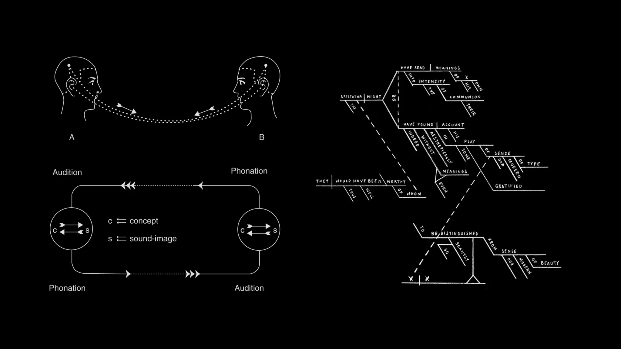
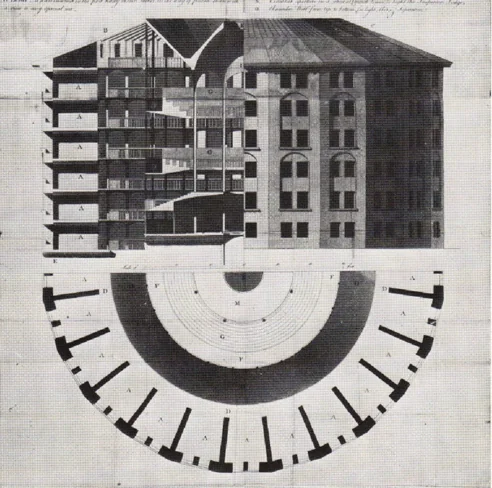
Architectural and urban theory has repeatedly turned to this parallel. In different ways, Umberto Eco, Guy Debord and the Situationists, and Michel Foucault made the city legible as a structure through which meaning, ideology, and power are communicated and reproduced.
Christopher Alexander and his collaborators approached the problem more generously, treating space as a network of embodied encounters. As I wrote in the first post here, each pattern in A Pattern Language addresses a recurring problem while remaining nested within larger patterns. The character of a room depends on its relationship to a building, a garden, or a street. The language lies in how those relationships fit together.
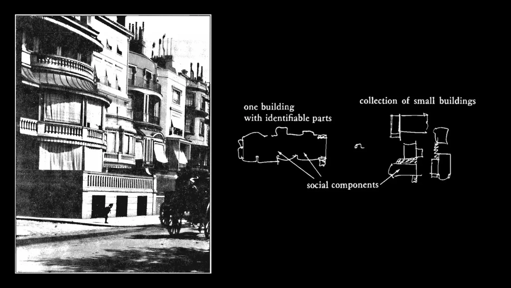
My contention is that the connection between space and language is more than figurative. Both become intelligible through recurring, learnable arrangements of parts: familiar elements, conventions about how materials meet, how boundaries are marked, and how one space opens into another.
This extends the argument about perception. Space is something we think with as well as something we think about. We think with our bodies, with other people, and with the environments we inhabit. In this account, cities, bodies, and brains participate in a connected structure, and culture and perception take shape across social and environmental scales.
Geographic differences in ways of making cities, buildings, and landscapes are therefore a fundamental part of how people make their lives and relate to the Earth with others. These are the stakes when we invoke Baukultur: the cultures and practices through which we shape our surroundings.
Recognizing a place before we can explain it
You might recognize Paris in a photograph even if you had never stood at that particular location. Asked how you knew, you could begin listing things: the proportions of the street, the building materials, the way the roofs meet the sky, the species of trees. Designers have an elaborate vocabulary for doing this, but recognition usually arrives before its explanation. You know where you are before you have finished accounting for how you know, much as you might recognize French without speaking it.
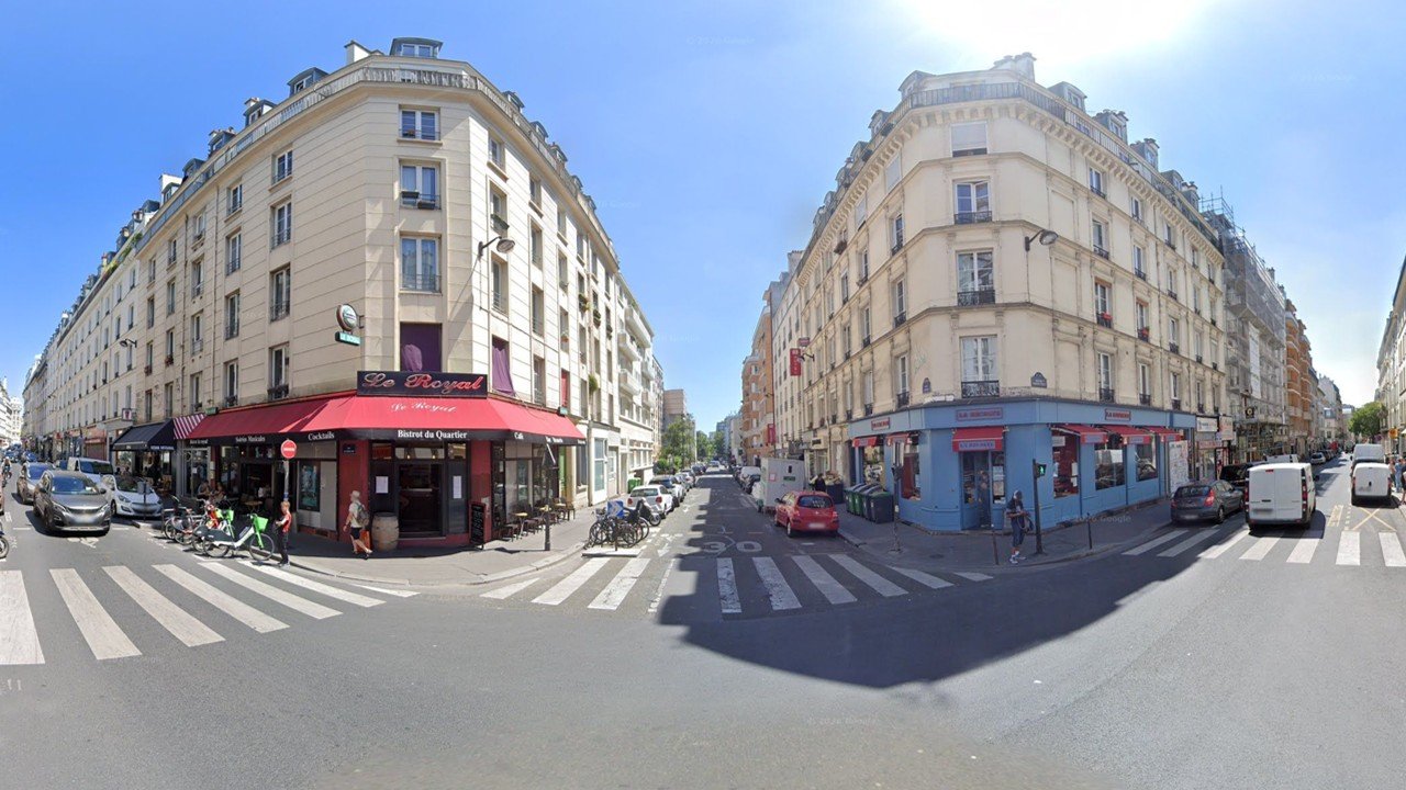
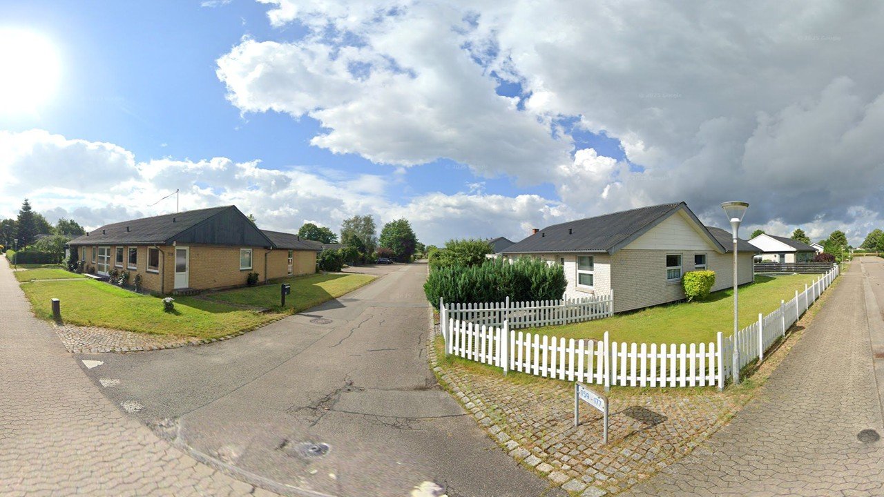
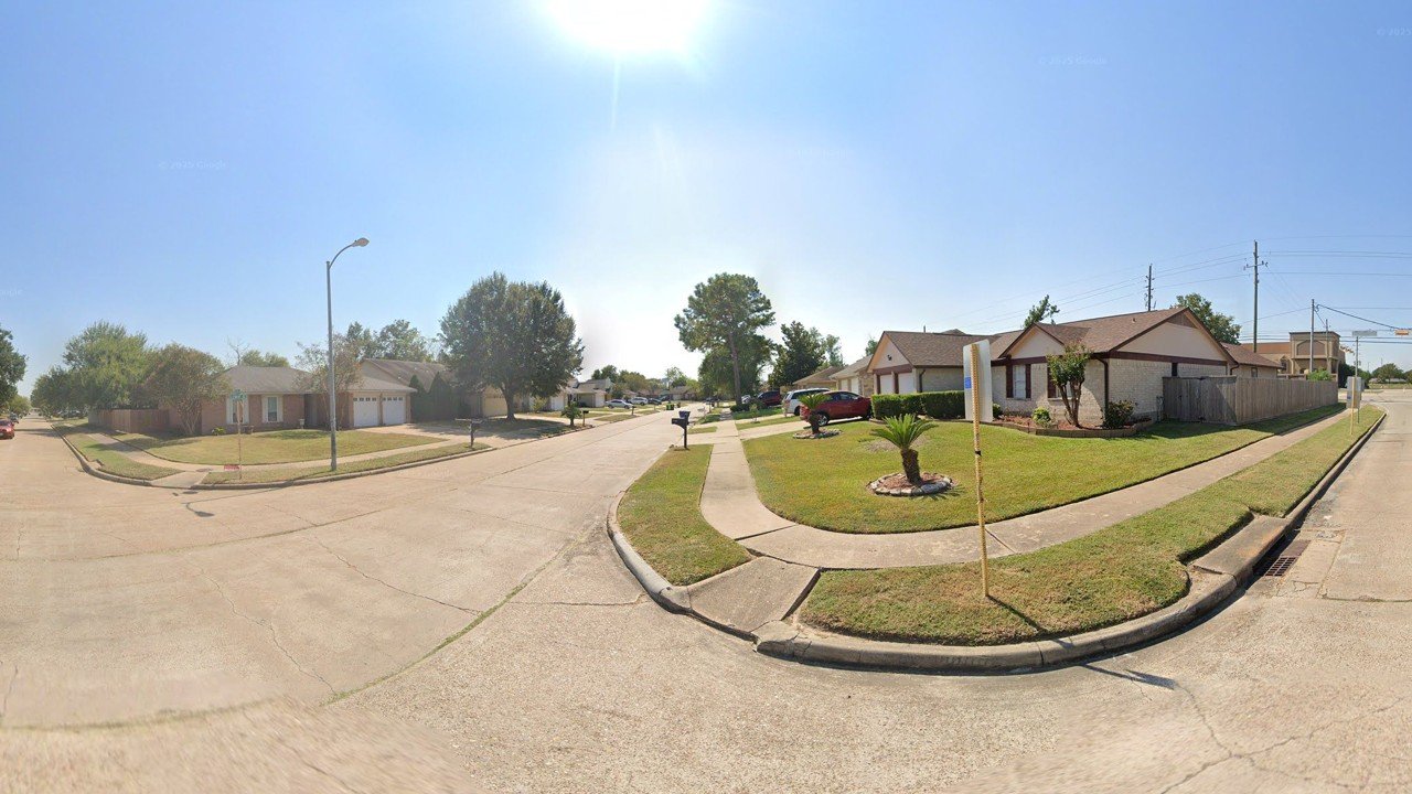
Places far apart can also share a recognizable vocabulary. A residential neighborhood in Norway and one in Texas may have different histories and populations while organizing life around similar relationships: the nuclear family, the detached house, the view from a moving car. We learn to read these relationships and assign them meaning before we can articulate everything in the scene.
That ability to recognize a place is evidence of a structure that is both learnable and already learned. The image of Paris is distributed among its inhabitants, its visitors, the photographs and films through which others encounter it, and the material organization of the city itself.
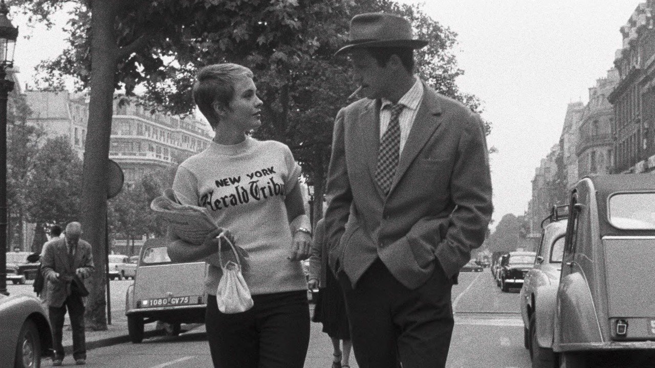
The European Landscape Convention places this relationship at the center of its definition of landscape: “an area, as perceived by people, whose character is the result of the action and interaction of natural and/or human factors.” Perception is doing substantial work in that sentence. Landscape exists as an idea that refers to a real place, something like what the urban planner Kevin Lynch called a public image.
The recurring relationship between a setting and what people do there, the ways we learn to recognize and inhabit it, and the public image formed through those experiences all point toward what I am calling a landscape signature.
My working definition is that the landscape signature is the patterned subset of landscape structure selected by attention, stabilized through repeated experience, and made socially meaningful through memory, use, and practice. Out of everything physically present, it is the recurring combination of elements and relationships that people notice, remember, and use to make sense of where they are, often before they consciously think about it.
Two spaces: the map and the image
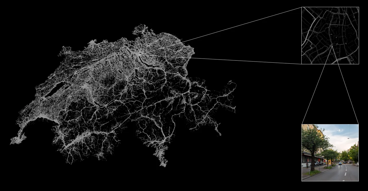
How might we begin to measure something like this? My research at ETH Zürich starts with photographs: more than 16 million street-level and ground-level images from 10 million locations throughout Switzerland. Each records an encounter with a place, from a particular vantage point and at a particular moment. Together, they make it possible to examine how visual elements and their arrangements recur across a country. They offer a way into the visible structure of landscape; the social meaning of that structure remains a larger question than photographs alone can answer.
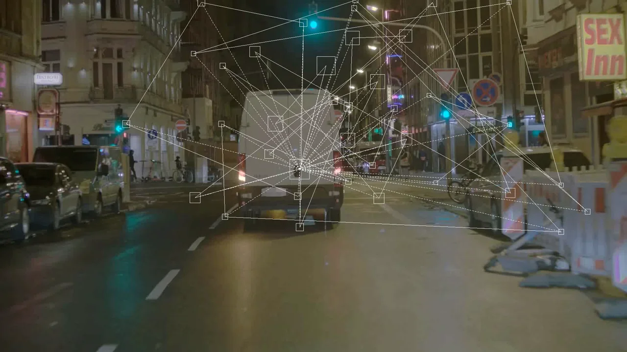
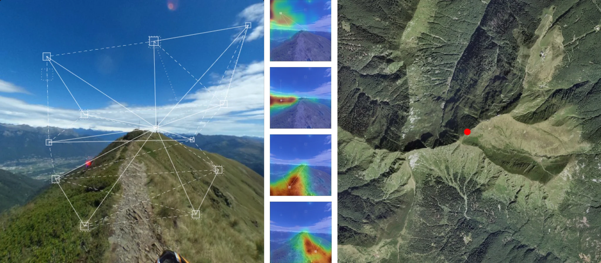
To read this archive, I start with a pretrained computer vision model called a vision transformer. It divides an image into small patches and produces numerical representations of their visual features. These representations, called embeddings, place patches in a shared space of visual relationships. Similarities and differences can then be examined as distances and directions in that space.
I extract these representations, trace them back to the parts of the photographs they came from, and compare how they change across millions of images. This is the raw material from which I build my own model.
There are two different spaces at work. One is geographic: the physical map of Switzerland, where the photographs were taken. The other is visual: a numerical space organized by the features the model represents. A street corner in Biel might sit close to a street in St. Gallen in visual space while being quite unlike another photograph taken fifty meters down the road. Projecting those relationships back onto the map lets us ask where particular spatial qualities recur, and what makes a place distinct.
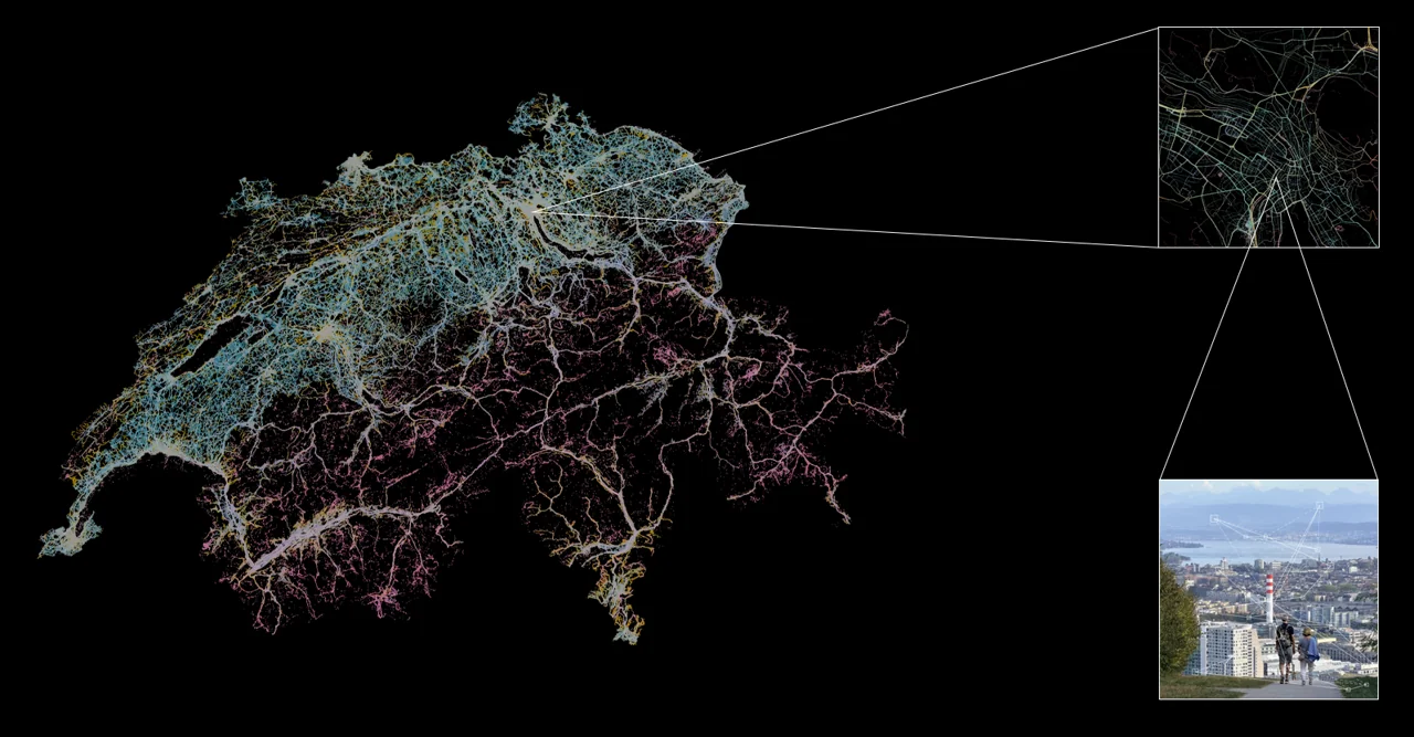
When I began, I expected to find something like a catalogue of Swiss landscape types: clusters that would neatly separate alpine villages, suburban peripheries, and agricultural valleys. The national analysis did reveal concentrations and recognizable differences. But the boundaries between them depended on where we chose to draw the lines. What emerged in this analysis was closer to a continuous spectrum than a set of discrete types. Red and orange are recognizably different colors, even though there is no single, necessary point at which one becomes the other.
What makes a place recognizable is rarely an element that exists nowhere else. More often, it is a particular proportion and combination of elements that are, on their own, quite ordinary.
What is there, and how it is arranged
To capture these combinations, I divide each image into an eight-by-eight grid, retaining the relationship between each tile's visual features and its position in the frame. I then train a model to learn which visual qualities consistently occur together across Swiss landscapes. The resulting coordinates describe continuous axes of variation, while allowing changes along an axis to be traced back to the parts of the image that drive them.
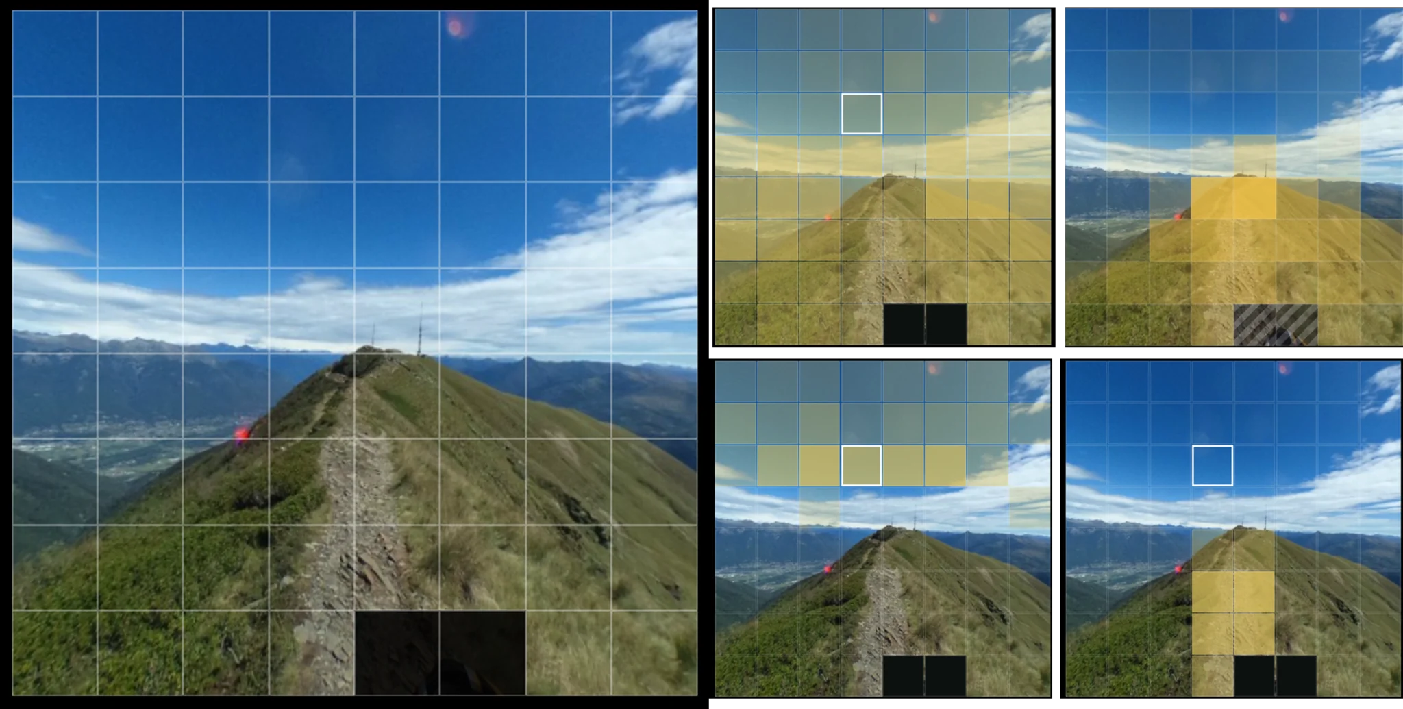
On one such axis, independent text descriptions of images at opposite ends bring out a recognizable contrast. Words such as “forest,” “leaf,” “dense,” and “branch” gather at one extreme; “building,” “roof,” “park,” “house,” and “window” at the other. The numbers alone do not establish what the axis means. I have to return to the photographs to see what is changing: vegetation and built form, topography, seasonal snow, or perhaps the camera's framing. Moving between coordinates and photographs is how we establish what the model has learned about the landscape.
Once we can track what appears in a landscape, the next architectural question is how those parts are composed. Imagine the same trees, cobblestones, and facades arranged around an open public square and along a narrow passage. An inventory might describe the two places similarly, yet how you move, where you look, and how you encounter other people would be different. Trees can frame an opening, channel movement, or block a view. What an element does depends on its relationship to everything else.
By separating content, the visual features present in an image, from configuration, their arrangement, the model lets us examine what composition contributes beyond an inventory of parts. Across the national collection, we can compare similar elements in different arrangements and explore how spatial qualities combine.
The first way of working with this model is territorial: comparing whole scenes and spatial arrangements across the country. The second is local. A higher-resolution grid allows us to examine a place such as Zürich and ask how an individual architectural or landscape detail relates to the urban scene around it.
What I am building toward is a way for architects and designers to turn an intuition, the feeling that two places share a particular sensibility or tension, into an explicit spatial relationship that can be examined, reproduced, and discussed. It would give us a shared basis for considering what to carry forward in a project, what to disrupt, and what new relationships to introduce.
Working with an existing grammar
The question that began for me in an occupied park is still present in this work. If spaces participate in how people think and act, then changing a space means intervening in those relationships. This is as true of a forest path or an urban farm as it is of a street, a public square, or an institution.
Our task as designers is to learn to read the relationships that already make places what they are, and to work with their existing grammars and vocabularies. We can bring familiar elements into unfamiliar relationships, introduce something unexpected, or change the significance of what has been there all along. Every intervention enters an existing structure of meaning and participates in changing it. The question is how well we understand that structure, and how deliberately we can work with it.
Photographs and research graphics by Justin Booz unless otherwise credited. The Cooperation Operation photographs are by Monica Wizgird, 2013. Paired photographs are cropped for the page layout; click an image to view its full frame.